
01 / DEFINE
Establish the Project
Set the project location and UTM spatial reference. Prepare the study geometry and supported mapping data.
Product Overview
dhwaniPRO is desktop software for modelling outdoor sound propagation. It combines acoustic sources, site geometry and receptors within a spatially referenced project, allowing users to calculate and examine sound levels across a defined study area.
The modelling environment supports calculation methods, source-to-receptor propagation paths, noise contours and technical reporting. Advanced spatial and analysis capabilities depend on the selected edition.
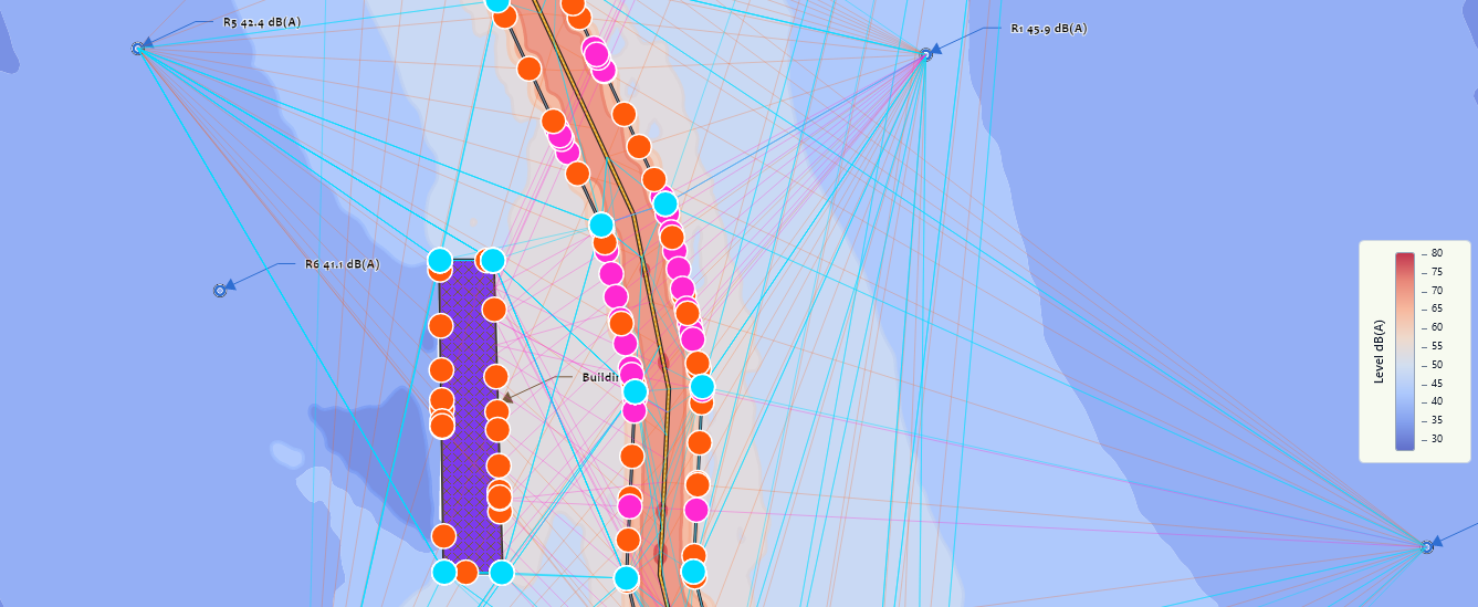
Modelling Workflow
A connected modelling workflow keeps project geometry, acoustic inputs and calculated results together.
Set the project location and UTM spatial reference. Prepare the study geometry and supported mapping data.
Add sound sources, buildings, barriers, receptors and other supported elements that influence outdoor propagation.
Select an available calculation method and evaluate sound propagation between sources and receptors.
Examine receptor levels, noise contours and supported analysis views. Prepare figures and technical outputs.
Product Scope
dhwaniPRO supports outdoor noise modelling using defined propagation methods, represented site geometry and acoustic source data. It is not designed for indoor room acoustics, architectural reverberation or full aircraft noise profile modelling.
Regulatory and project noise criteria are user-defined. Calculation results must be interpreted within the assumptions and limitations of the selected method.
dhwaniPRO provides core outdoor propagation modelling. Vector extends the available methods, geometry, GIS and analysis tools. Delta provides advanced academic modelling subject to licence restrictions.